

.jpeg)


 (2)1.jpg)


 (1).gif "DMG")
1.jpg "Kennedy Hire")


.jpg "Tri State Parking Lot")


1.jpg "Last Call Spirits")


.jpg "Marler Probate Judge")


.jpeg "The Plant")


Jim Cantore in Panama City Watching the Weather
Matt BosterViewed: 7802
Posted by: Matt Boster
Date: May 15 2018 8:04 AM
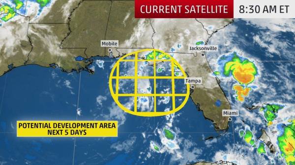
WEATHER CHANEL: An area of low pressure in the eastern Gulf of Mexico is being monitored for subtropical or tropical development this week as it spreads heavy rainfall across Florida and other parts of the Southeast U.S., potentially giving the 2018 Atlantic hurricane season an early start.
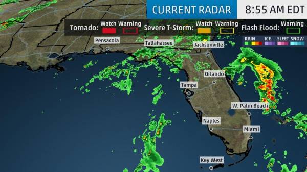
The National Hurricane Center is currently giving the system a low chance of development into a subtropical or tropical depression or storm over the next five days. Heavy rainfall will be the primary concern regardless, especially in the Sunshine State.
For now, the disturbance consists of a well-defined upper-level swirl of low pressure but a disorganized, elongated area of low pressure at the surface. This system has not become any better organized since Monday and conditions are becoming less favorable for development.
If surface low pressure becomes a well-defined circulation with enough convection nearby, this would be the first subtropical or tropical depression or storm of the 2018 Atlantic hurricane season, which doesn’t officially begin until June 1. If it reached tropical storm strength, it would earn the name Alberto.
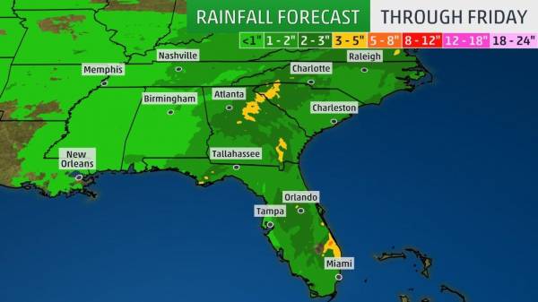
Much of Florida can expect 1 to 3 inches of rainfall through the week. Locally higher amounts are expected in heavier thunderstorms, and totals of 3 to 7 inches are likely in southeastern and eastern Florida.
This tropical moisture pipeline will also fuel downpours that result in rainfall totals of 1 to 3 inches across other parts of the Southeast – and eventually into the Northeast – this week.

<- back


1.jpg "Marler for Probate Judge")

.JPG "Wiregrass Electric")


 (2).jpg)


.jpg "Harley Davidson")

.jpg "Kennedy Hire")


1.jpeg)


.jpg "Last Call Spirits")


