


 (2)1.jpg)


.jpg "Marler Probate Judge")
1.jpg "Last Call Spirits")


1.jpg "Kennedy Hire")


.jpeg)


.jpg "Tri State Parking Lot")

 (1).gif "DMG")


.jpeg "The Plant")


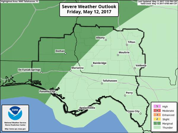
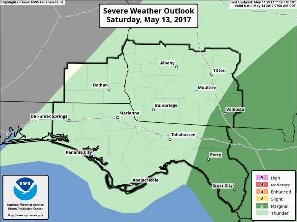
Marginal Risk for Severe Weather Tonight
Matt BosterViewed: 3340
Posted by: Matt Boster
Date: May 12 2017 7:16 AM
A cold front will move through the region early this evening through the overnight hours, exiting the southeast Big Bend of Florida on Saturday afternoon.
The SPC has placed the NW third of our region (NW of a line from about Albany through Panama City) under a Marginal Risk for severe storms this evening and the early part of the night. The main threat will be strong to isolated severe wind gusts.
Overall, this a relatively low-end threat. Both outlooks are attached to this email.

<- back


.JPG "Wiregrass Electric")


 (2).jpg)

.jpg "Harley Davidson")


1.jpeg)


.jpg "Last Call Spirits")


1.jpg "Marler for Probate Judge")


.jpg "Kennedy Hire")