

.jpg "Marler Probate Judge")


.jpeg)


 (1).gif "DMG")


1.jpg "Last Call Spirits")


.jpeg "The Plant")

 (2)1.jpg)
1.jpg "Kennedy Hire")
.jpg "Tri State Parking Lot")


8:14 AM. Alberto Latest Update
Rickey StokesViewed: 5494
Posted by: RStokes
Date: May 28 2018 8:19 AM
ALBERTO LATEST UPDATE
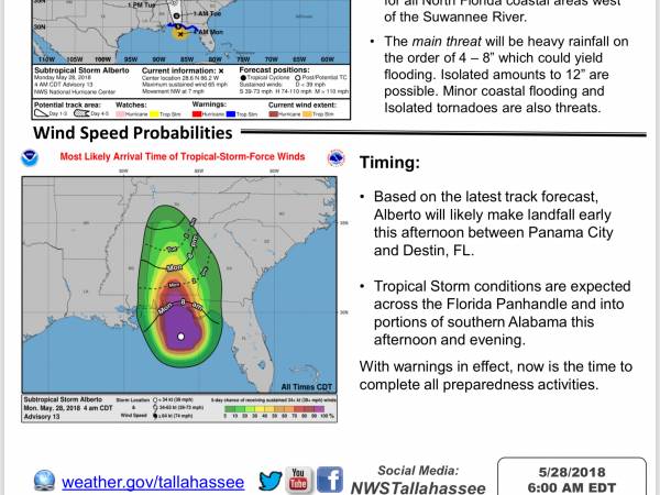
Alberto is expected to make landfall this afternoon in the Florida Panhandle.
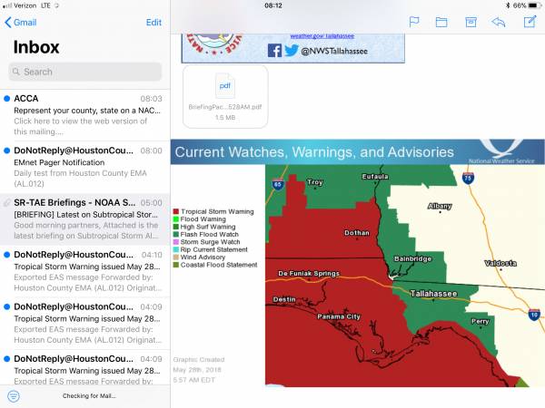
• Tropical Storm Warnings are in effect for the entire FL Gulf Coast, as well as inland portions of the FL Panhandle and portions of southern AL.
• A Storm Surge Watch remains in effect for all North Florida coastal areas west of the Suwannee River.
• The main threat will be heavy rainfall on the order of 4 – 8” which could yield flooding. Isolated amounts to 12” are possible. Minor coastal flooding and Isolated tornadoes are also threats.
Basedonthelatesttrackforecast, Alberto will likely make landfall early this afternoon between Panama City and Destin, FL.
• TropicalStormconditionsareexpected across the Florida Panhandle and into portions of southern Alabama this afternoon and evening.
With warnings in effect, now is the time to complete all preparedness activities
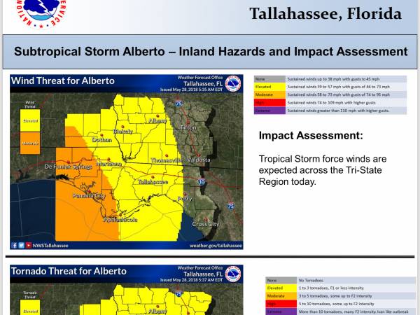
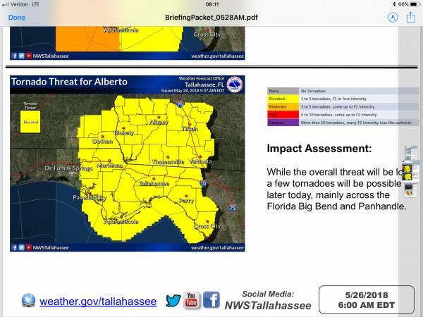
Tropical Storm force winds are expected across the Tri-State Region today.
Impact Assessment:
While the overall threat will be low, a few tornadoes will be possible later today, mainly across the Florida Big Bend and Panhandle
A Storm Surge Watch remains in effect for the entire Florida Gulf Coast.
Impact Assessment:
There is potential for storm surge along the entire Florida Gulf Coast with water levels 2 to 4 feet above ground level.
Timing:
The coastal flooding threat will increase this afternoon during the high tide cycle.
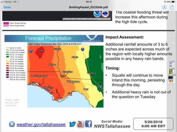
Impact Assessment:
Additional rainfall amounts of 3 to 6 inches are expected across much of the region with locally higher amounts possible in any heavy rain bands.
Timing:
• Squalls will continue to move inland this morning, persisting through the day.
• Additional heavy rain is not out of the question on Tuesday

<- back


 (2).jpg)


.jpg "Last Call Spirits")

1.jpeg)
.jpg "Harley Davidson")


.jpg "Kennedy Hire")


.JPG "Wiregrass Electric")


1.jpg "Marler for Probate Judge")


